If you can see Mt. Baker, you are part of The Experience
Unlike last year, it’s actually snowing in the North Cascades this winter. That’s good news for skiers and snowboarders but bad for hikers hoping for a repeat of 2015, when you could get to many high country trails in June.
The high mountains can’t be beat, but northern Cascadia has plenty of hikes below the snow line. The foothills and the Chuckanut Mountains have a season’s worth of hiking destinations, and the San Juan Islands have plenty more trails leading to waterfalls, beaches and island-studded views. Here are a few of the best.
Squires Lake and Alger Alp
Length: 5 miles out and back
Elevation gain: 1,000 feet
Getting there: Take exit 242 on I-5 and head east. Turn right onto Nulle Road and continue for about a mile to the signed Squires Lake Park parking lot on the left.
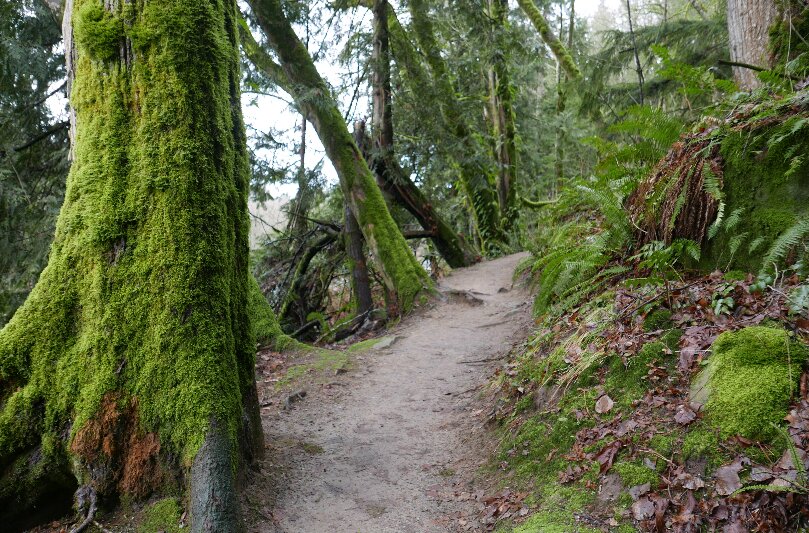
The hike: Squires Lake, on the south end of the Chuckanut formation, is a popular destination for a short walk. Alger Alp, a couple miles beyond the lake, is a lesser-visited high point in the Chuckanut formation with views that reach all the way to the Puget Sound and San Juan Islands.
A short, steep trail switchbacks up a forested slope from Squires Lake Park to Squires Lake, a 0.3-mile walk. A popular loop trail circles the forested lake, leading to viewpoints and benches.
To continue to Alger Alp, go right (south) at the lake and find the trail up a forested ridge leading beyond the boundary of Squires Lake Park. The trail meanders through salal and Oregon grape along a narrow ridge until it meets an abandoned logging road, about 1 mile from the parking lot. From here, follow roads to the summit of Alger Alp. Continue straight at a junction where a road leads to the right, down a hill. Bear right at another junction and left at one more, maintaining a generally uphill course along the road.
About 2.5 miles from the trailhead, the road arrives at the summit of Alger Alp. A ledge above sandstone cliffs on the summit’s west side provides views toward the Salish Sea, as well as the fields and farmlands at the border of Whatcom and Skagit counties.
Raptor Ridge
Length: 5.2 miles out and back
Elevation gain: 1,300 feet
Directions to trailhead: Two separate trailheads have routes to Raptor Ridge. The longer one starts at Arroyo Park, just south of Fairhaven. The shorter, steeper approach described here starts at the Pine and Cedar Lakes trailhead.
To get there from Bellingham, go south on State Street toward Fairhaven. Continue south from Fairhaven on Chuckanut Drive for 1.5 miles to the junction with Old Samish Parkway. Turn left onto Old Samish Parkway and continue for 2 miles to the parking lot on the south side of the road.
The hike: While it’s nowhere near as popular as Oyster Dome, farther south in the Chuckanut Mountains, the jaunt up Raptor Ridge is one of the best in the small coastal range. This part of the Chuckanuts is packed with beauty – nearby Pine and Cedar lakes also make great destinations, and so does a viewpoint above Cedar Lake with a peek-a-boo view toward the San Juan Islands.
From the south end of the parking lot, the trail begins climbing steeply on a wide path. The grade doesn’t relent as the trail climbs through a forest of firs and cedars. The trees get older as you climb. In 1.5 miles, go right at a junction with Hemlock Trail (left goes toward Pine and Cedar lakes). From here, continue for 0.3 miles and take a left at a signed junction with the Raptor Ridge Trail, which leads uphill.
The climax of the hike is a rocky outcrop on Raptor Ridge, where hikers can recline on sandstone and look south into the relatively remote center of the Chuckanut Mountains.
Mountain Lake Loop, Orcas Island
Length: 3.9 miles round-trip
Elevation gain: 50 feet
Getting there: From Eastsound on Orcas Island, go east on Crescent Beach Road toward Moran State Park. Turn right onto Olga Road and follow it south into Moran State Park. Bear left onto Mount Constitution Road, 1.4 miles from the entrance to Moran State Park. Stay right in 1 mile to turn onto Mountain Lake Turnoff. Park at the lot in Mountain Lake Campground, near the end of the road.
The hike: The Mountain Lake Loop is a perfect excuse for a spring getaway to Orcas Island. The deep blue lake is a world-class swimming hole in the summer, but in winter and spring it’s quiet and relatively deserted. On quiet days only the sound of water lapping against the shore accompanies hikers on the gentle path along the forested lake.
From the parking lot, go north on a flat path along the lake’s western shore. The lake is about 100 feet deep at its deepest, according to a report by the San Juan County Water Resource Management Committee. Several little islands reach out of the depths to break the surface on this western stretch of shore.
Along the way, a couple of trails lead away from Mountain Lake to Twin Lakes and Mount Pickett. For the 3.9-mile hike, simply hug the shore at each junction. You’ll pass through dense forest and marshes and along small cliffs above the lake. Cross Cascade Creek on a bridge at the south end of the lake and continue 0.8 miles more to reach the parking lot. x


