If you can see Mt. Baker, you are part of The Experience
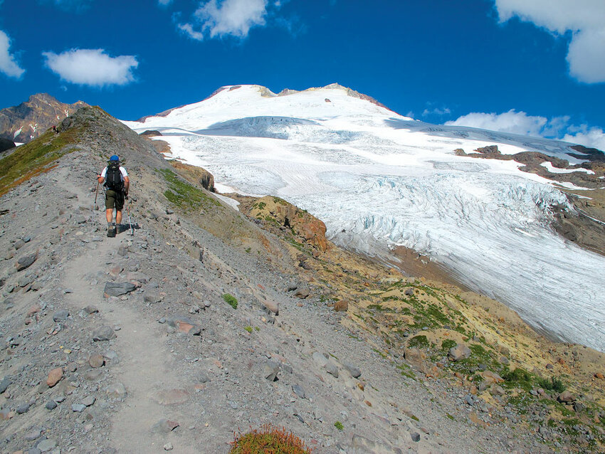 Railroad Grade trail, on the south side of Mount Baker, is named for its even grade.
Nisqually Road in Mt. Rainier National Park was touted as “the first road in America to reach a glacier” when it was built, according to the Library of Congress. The Nisqually Glacier once came within 140 feet of the road at the Nisqually bridge, but now the glacier isn’t even visible from the bridge.
Though it’s no longer possible to get anywhere near a glacier on a road in the lower 48, it’s still pretty easy to go see a glacier from a trail, at least in the Mt. Baker area. Trails on the north and south sides of the mountain bring hikers within spitting distance of the Coleman and Easton glaciers, where they can gape at cracked ice and human-swallowing crevasses without leaving the relative civilization of a trail. Bring a Northwest Forest Pass for both hikes.
Length: About 5 miles
Elevation gain: About 2,000 feet.
Getting there: From Glacier, go east on Highway 542 for slightly more than a mile and turn right onto Glacier Creek Road/Forest Service Road 39. Follow the road for about 8 miles, bearing left at a junction just before the trailhead.
The hike: The Heliotrope Ridge Trail is the quickest route to a glacier in the area. In just 2.5 miles, it reaches the icy, broken snout of Coleman Glacier. The trail is also the beginning of the most popular route to Mt. Baker’s summit, the Coleman/Deming route.
The trail starts out in the forest on a well-worn path through old-growth fir and hemlock trees. You’ll wind through groves of trees and on bridges over glacier-fed creeks for a couple miles before reaching the tree line. In the subalpine zone, little waterfalls spray onto gardens of pink monkey flowers and purple lupines sprouting from rocky soil.
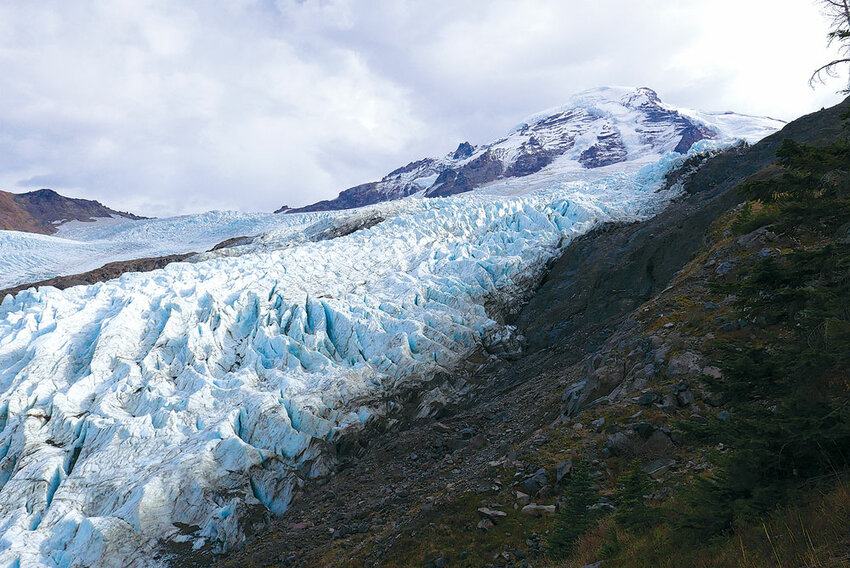
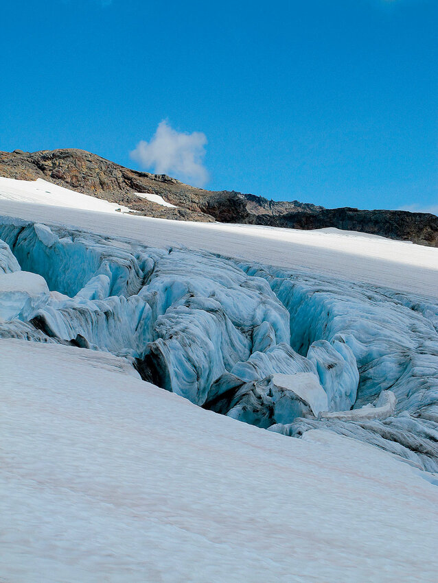
Above the forest the trail splits. A climber’s path heading right toward Hogsback Ridge, which leads to base camp for climbers intending to summit. The hiker trail goes left to cross Heliotrope Creek’s sprawling, rocky bed. This can be dangerous, depending on the water level. If the creek is low enough to safely cross, head toward a dark basalt outcrop on a ridge. The hike ends on the ridge just past the outcrop, on top of a lateral moraine. Down below, the Coleman Glacier is a mess of blue seracs and pinnacles. Chunks of ice grind down the valley, pushed by the massive glacier stretching nearly to the mountain’s summit, more than 5,000 feet above.
Length: About 7 miles
Elevation gain: About 2,500 feet
Getting there: From Burlington, go east on Highway 20 for 23 miles. Turn left on Baker Lake Road, just after milepost 82. Continue for 12 miles and turn left on Forest Service Road 12. In 3.4 miles, turn right onto Forest Service Road 13, which is signed Mt. Baker National Recreation Area. Follow this road for 5 miles to its end at the trailhead.
The hike: The snout of the Easton Glacier has a different character than that of the Coleman. Its slope is gentler and the ice is more continuous than the mass of seracs at the bottom of the Coleman. What crevasses you can see from the trail, however, seem to lead to the bottom of the earth.
The walk to the Easton Glacier starts in a huckleberry-dense meadow dotted with clumps of trees. The tread crosses several rocky alleys of decimated forest, with vegetation torn from the ground by flood runoff from the mountain above. Find a safe crossing over Rocky Creek; the best place to cross changes from year to year.
After a series of switchbacks through firs and cedars, the trail reaches Morovitz Meadow, a park-like setting filled with flowers, clusters of trees and shallow ponds. Bear left at a junction with the Scott Paul Trail two miles from the trailhead, and go right at a junction with the trail to Park Butte a half-mile later. Soon you’ll be chugging up the Railroad Grade trail toward the glacier, with Mt. Baker straight ahead with the Twin Sisters Range behind you.
The Railroad Grade trail and its close-up view of the Easton Glacier is just one of many places to explore in the area. To extend your trip, check out the fire lookout on top of nearby Park Butte or take the long way back on the Scott Paul trail, which crosses Rocky Creek on a bridge below the glacier and continues east on a 5-mile loop back to the trailhead.


