If you can see Mt. Baker, you are part of The Experience
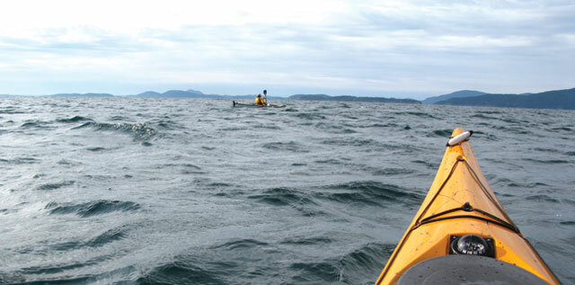 |
| 'ROUND LUMMI Circumnavigating “the other” islandBy Dave Peebles The islands present a number of impediments to the would-be tourer, however, which I suppose is actually part of the charm. Among these are the long crossings over congested waters roiled by strong currents or crowded state ferries. Having spent part of my youth in the eastern Washington town of Chelan, and in, on and around the beautiful lake that bears its name, it puzzled me that many lifelong residents had never taken a boat to the head of the lake. The attitude seemed to be that “It’s always there, always has been, and I’ll go someday.” I think a similar notion prevails amongst many locals concerning the San Juan islands. Kayakers the country over, however, regard the islands as a world-class destination, and they rank high on many “must-do” lists. The islands present a number of impediments to the would-be tourer, however, which I suppose is actually part of the charm. Among these are the long crossings over congested waters roiled by strong currents or crowded state ferries. And when you get to whatever island you have chosen, you often find launching sites sparse, lacking in parking room and costly. Another way to sample island charms is to tackle Lummi Island. It’s safe to ignore the tepid controversy over whether it really is part of the San Juans, since it is in Whatcom, not San Juan County. The approach to the island does not require a long, hazardous crossing from the preferred put-in, and the wonders of the island itself make this a very worthwhile trip. It can be approached as a one-day circumnavigation or as an overnighter or longer getaway. GETTING THERE. The easiest put-in is at Gooseberry Point. Though the beach is a few hundred yards west of the ferry landing and is part of the Lummi Reservation, the tribe has always tolerated our using it. As soon as you’ve offloaded your boat and gear, park across Lummi View Drive in the designated area. For all the years we have used this launch and parking area, I have never heard of any security problems with the vehicles left for the day or overnight. I would avoid it, however, during periods when the ferry is out of commission, as many of the islanders park there for the duration. Some paddlers prefer to approach the island via longer crossings. You can put in at Squalicum Harbor in Bellingham or from Wildcat Cove at Larrabee State Park. Don’t forget that you will need a Discover Pass for your vehicle to park at Larrabee. Although the route from Bellingham needn’t take you far offshore, you are exposed to the open waters of Bellingham Bay, which can be as benign as a lake, or truly tempestuous during stormy weather. From Larrabee, you have a major crossing to make of about four-and-a-half nautical miles, and nearly seven nautical miles from Squalicum Harbor. Here’s an idea to make your decision easier: travel along the shore is much more interesting than open crossings; as the time-honored adage says,“the longest distance between two points may be way more fun than the shortest one.” Yes, I just made that up. To do a circumnavigation, start from Gooseberry Point. You can either paddle directly down channel or make your crossing over to the island straight off. Do your best to dodge the Lummi Island Ferry, which makes frequent runs, especially on weekends. This is the route I prefer. If you want to make your circumnavigation more efficient, try to ride the ebb tide south and the flood north, whether you decide to go clockwise or counterclockwise. Times of slack and direction, as well as force of tidal currents, vary tremendously throughout the area. This is because all that water sloshing through the islands on its way to the Strait of Georgia, and flushing back out again, has to find its way through a veritable maze of twists and turns. A reliable tide table, such as Capt’n Jack’s Tide & Current Almanac, will give you the most detailed information; the inexpensive guides from the local drugstore are almost useless. One feature of paddling in the San Juans is that this is not wilderness adventuring. In fact, much of it I would describe as rural, and some even suburban. One of the delights of a Lummi circumnavigation is that while the north end will seem more or less rural or suburban, in the south it becomes truly wilderness. The wilderness portion starts soon after you have passed the huge rock quarry on the island’s east side. The first major feature you’ll see (and a tempting stopover) is Inati Bay, also called Smugglers Cove. The land around the cove is private property and, according to the owner, so is the water in the bay itself. (I don’t know whether that controversy was ever resolved). For years, Bellingham Yacht Club has had a working arrangement with the owner, but a kayak isn’t a yacht. In any case, it’s best not to stop here. LANDING SPOTS. A couple of miles farther along, directly opposite the north end of Eliza Island, you’ll find the Lummi DNR (Department of Natural Resources) camp. This is a lovely site perched on rocky cliffs, with picnic tables, tent pads and fire rings. There are also outhouses. Bring your own water, as none is available here. Whatcom Association of Kayak Enthusiasts (WAKE) volunteers cooperate with the budget-challenged DNR crew in maintaining this site. I fear it would be closed altogether were it not for the effort from WAKE. About a mile and a half farther along, you come to Carter Point, the southern end of the island. If you started your trip down Hale’s Pass in blustery, choppy conditions, you may notice a curious phenomenon as you round Carter Point: the west side of the island, at least for the first few miles, may be strangely calm. I surmise that the southwesterly winds (our usual stormy weather) are abruptly thrust upward when they hit the steep, high bulk of Lummi Mountain, leaving an area of dead air at sea level. Also curiously, the currents here, up at least to Lummi Rocks, are described in the tide and current guide as “weak and variable.” The rocks, which lie a few hundred yards offshore, are a worthwhile stopover. They are administered by the federal Bureau of Land Management, part of the Department of the Interior. This is a strange and fascinating place. There are two good landing beaches here, flanking a tombolo that joins two of the rocks. It’s a nice place to stretch your legs and have lunch. If you happen to be here at the turn of the tide, you can actually watch and hear the movement begin with a swirl and a rush. A small tidal rip may form on the west side of the rocks. This is a fragile environment, with wildflowers and grass and a few shrubs growing. If you climb (carefully) to the top of the rock closest to Lummi Island, you will discover long, shallow grooves carved into the rocks. These are the signatures of glacial action. Some of the grooves are a foot or more wide, and continue for a hundred yards or so. You can also see these grooves from the water if you round the rocks on the west (Lummi) side. The Puget Sound glacier is believed to have overtopped Orcas Island , which you can see to the northwest. Lummi Rocks must have been a much tougher formation to have withstood the mighty forces of this glacier. Lummi Mountain looms overhead here, and often, if there is an onshore breeze, you will see eagles and turkey vultures soaring at the very top in the upward flowing air. Lummi Island actually consists of two distinct geological formations, with quite different histories. The mountainous south portion is said to have originated far off shore and to have ridden the Juan de Fuca plate eastward to its present position. At least on the westside beaches, the rock is primarily shale. The low lying north end, on the other hand, is locally formed Chuckanut sandstone, which is also found around Wildcat Cove, Clayton Beach, and Sucia, Matia and Clark Islands – and even into the Canadian Gulf Islands. The two formations welded themselves into one in their collision. I have heard there are actually places on the island where you can see the suture of this joining, though I myself have not seen it. It is along this low lying north end of the island that the environment again becomes rural or suburban. Continuing north, you have two choices: paddle alongshore, or venture out into Rosario Strait to ride the current north. Since the alongshore stream has to go farther, even around the broad curve of Legoe Bay to Village Point, it flows faster. One time I took this route while others stayed in the middle of the main current, and we all arrived at Village Point at the same time. As you work your way north, be aware that there may be reefnetters at work scooping up salmon, using a technology invented long ago by the Native Americans. The visible part of the operation consists of ranks of scows anchored in pairs. Between each pair stretches a reef net that slants underwater toward the incoming tide and oncoming fish. The net is covered with plastic ribbons resembling eelgrass – in other words, it looks like the bottom. As the salmon swim over this artificial reef, spotters on towers signal their arrival, and the net is hoisted before the salmon can pass over or retreat. A friend of mine who used to be a spotter said it can be the most boring job in the world, though maybe overly exciting if to be perched on one of those towers during stormy conditions. As the flood current flows strongly northward through the lines of reefneters, watch out you don’t get caught up in a net. It could be embarrassing. Boundary Bay brews their Reefnetter Ale in honor of these fishermen. Having paddled through or around the reefnets, you’ll have a fuller appreciation for the ale, which I recommend. A mile or so north of Village Point, a dike or ridge extends a considerable distance out into Rosario Strait, making for some interesting current activity. Often you will not only see rips or overfalls, but may hear them as well. Should you get caught out and get swept into a rip, there’s no need to fight your way out; just concentrate on staying upright, and the current will flush you out the other side. Paddling along this shore north of Village Point, you will see sandstone formations much like those mentioned above. Though you may be tempted, the beaches here are all private property. As you round Point Migley, you’ll want to ascertain whether the tide has turned. If the ebb has started, it’s best to cross over to Gooseberry Point sooner rather than later. If it’s still flooding, take advantage of a big back eddy by hugging the Lummi shore all the way up to Lummi Point, before making your dash across to Gooseberry. You’ll be able to judge how much current you’ll have to cope with by observing the behavior of the big green navigation buoy at Lummi Point. If you’ve been carrying your GPS, you can track your actual route and know how many miles you really paddled. Though you could do your navigating with any old roadmap, or sketch on the back of an envelope, it’s best to carry an official chart. That would be chart 18421. If you have a very old one like mine, it’s a 6380. Apparently certain numbers fall out of fashion, but I can’t figure out why. Judging by the number of digits, it looks like a form of inflation. X Dave Peebles has done many Lummi circumnavigations and campouts and has paddled in Baja, Belize, Alaska, Australia, the west coast of Vancouver Island, the Queen Charlottes and B.C.’s inland passage. |


