If you can see Mt. Baker, you are part of The Experience
Story and photos By Jason Griffith
For the hiker who doesn’t ski, winter in the Pacific Northwest can be trying. The high ridges are blanketed in snow and clouds for months. The low winter sun makes the deep mountain valleys dark, sodden and unattractive for hiking or backpacking. After a summer spent in the glory of the alpine environs, the scruffy second growth and muddy trails of the lowland hills are an uninspiring substitute. It’s easy to let the fitness of summer fade as you putter around town and watch your hiking gear gather dust.
However, with some time and luck, there’s a way to combat the winter hiking doldrums without leaving the Pacific Northwest.
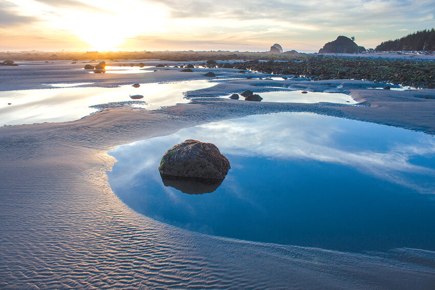
How? Head to the coastal section of Olympic National Park. Stretching for 73 miles from the mouth of the Queets River north to the Makah reservation, the coastal unit of the park has long sections of road-less wilderness with some of the most rugged, pristine and picturesque marine shoreline in the lower 48. Sea stacks, dramatic headlands, marine mammals, diverse bird life, tide pools and spectacular campsites make an overnight hike on the Olympic coast one of the more memorable outings you’ll do in a year.Sea stacks, dramatic headlands, marine mammals, diverse bird life, tide pools and spectacular campsites make an overnight hike on the Olympic coast one of the more memorable outings you’ll do in a year.[/quote_box_right] Like any successful summer trip to the alpine, however, an enjoyable trip to the coast isn’t possible every week of the winter, or even most. Tides, winds, weather and strategy are all factors for planning a safe and enjoyable trip to the coast.
The first thing you should know about hiking the coast is how far it is from the I-5 corridor – expect a six-hour drive, including a ferry ride and stop at the ranger station for a permit. I’d suggest a three-day window as the minimum amount of time for a backpack on the coast. The next item to consider, in light of the long drive, is whether you’re going to do a one-way hike or one that is out and back. The access points are few and far between on the coast and hitching back to your vehicle is problematic, so unless you have a large group with multiple vehicles, a one-way backpack is difficult.
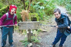
Fortunately, one spectacular section of the park’s coastal section is easily hiked as a loop. Known as the Ozette Triangle or Cape Alava Loop, this 9.4-mile trail passes through the complete coastal ecosystem mix.
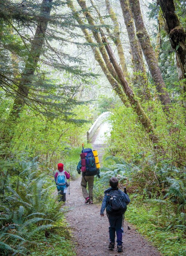
The hike starts out on the shores of Lake Ozette before crossing the Ozette River on an arched bridge and diving into the moss-draped forest. After a quarter mile is a junction. Head left toward Sand Point to hike the loop in a clockwise direction. That way you’ll walk north along the beach with the prevailing wind. A mixture of boardwalks and well-graded trail takes hikers 3 miles to the coast. The forest is a dense tangle of mature cedar, hemlock and spruce crowded with an understory of head-high shrubs and broken up by a patchwork of wet coastal prairies.
The forest makes it plain that it rains a lot (80-100 inches a year), and one of the challenges of coastal winter hiking is picking a window between storms. Be sure to check the surf conditions as well, since walking along the coast can be dangerous when storm surges push driftwood high into the forest and the beach offers little safety.
As you head toward Sand Point, the surf booming in the distance grows louder with every step. The gently rolling trail eventually drops off a low ridge towards the water as the dense forest gives way to the beach and groves of wind-blasted spruce (often “flagged,” with branches mostly on the leeward side) that will typify the next leg of the journey. Great camps (no fires, water from Wish Creek to the south) are tucked into the forest both south and north of Sand Point and after the long drive it makes a perfect place to set up camp and explore for the afternoon. The relaxed nature of coastal hiking (little elevation gain), combined with the beachcombing and tide-pooling opportunities make it perfect for family trips.
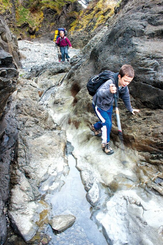
The next 3 miles of surf, sand, tide pools, sea stacks, birds and flotsam are the highlight of the Ozette Triangle. The hiking is easiest at low tide, so plan your departure from Sand Point accordingly. If you tend to dawdle though, don’t worry; the few rocky headlands that you must round have a high tide route through the forest marked with black and orange targets on the beach. These “trails” are usually steep and muddy, receiving minimal maintenance, but often have knotted ropes to assist with the steepest sections. Halfway to Cape Alava, as you begin to round a headland at Wedding Rocks, drop your pack and take a few minutes to find the petroglyphs carved into the rocks by the ancestors of the Makah – a reminder that what we now consider a wilderness has long been the home of coastal Indian people.
Soon after rounding Wedding Rocks, Cape Alava swings into view, the next night’s destination if you are on the relaxed itinerary. This is where the other half of the loop trail meets the coast and is home to many comfortable camps tucked into the forest above the high tide mark (fires allowed, water from unnamed creek to the south). The northern half of Cape Alava is on the Ozette Reservation and there’s a display summarizing the history of a tribal village that was buried in a mudslide at this location during the last “Big One” in 1700. The tide pooling here is worth an afternoon’s ramble. The nutrient-rich currents that sweep along this section of the coast support an amazing diversity of life including urchins, sea stars, crabs, anemones, fish and sea cucumbers. As you work your way offshore it is evident that the intertidal abundance is arranged in layers, with the distribution of species controlled by tidal exposure, wave energy, and competition for space.
After a restful night lulled by the ever-present surf, it’s time to turn inland and walk the northern leg of the loop back to the car. This section is similar to the southern branch of the trail, climbing steeply away from the wind-blasted spruce on the beach to the tangled forest and prairies leading back to Lake Ozette. You’ll pass Alhstrom’s Prairie, named for a pair of Scandinavian immigrants who homesteaded here in the early 1900s, about a mile from the beach, but any traces of their work have long since moldered into the peat. This leg of the loop is an ancient route that served the Indian village at the Cape (inhabited until the 1930s). Approximately 3 miles from Cape Alava you arrive back at the car having sampled a cross-section of what makes the Olympic National Park’s coast section so special. If the weather hasn’t been too unkind you may have just found a new winter pastime – there are 70 more miles of coast to explore!
Know before you go:
Permits: Needed for all trips to the coastal section of Olympic National Park. Fee is $5 per person/night; those 15 and under are free. Available at Port Angeles and Quinault NPS ranger stations. Advance reservations required for Ozette area between May 15 and September 30.
Water: All water on the coast needs to be boiled, treated or filtered to remove giardia or cryptosporidium.
Campfires: With the exception of the section between Yellow Banks and Wedding Rocks, fires are allowed. Driftwood only.
Toilets and sanitation: Toilets are located near the campsites at Cape Alava and Sand Point, and at various other high-use camp areas along the beach. In the absence of a toilet, dig a cat hole in the forest 200 feet from any campsite or water source.
General info: Bear canisters (available for reasonable rent at ranger stations) are required for overnight food storage. Carry a tide chart, a watch and a map and know how to use them. Twelve-person party limit. Flexible soled boots are better than stiffer ones for dealing with slippery rocks. Variable hiking surfaces, tides and headlands limit most hikers to 5-10 miles per day. No pets, stock or bikes. Map: Green Trails Ozette No. 130S. x
 Based in Mount Vernon, Jason Griffith is a fisheries biologist, member of Skagit Mountain Rescue, husband and father of two young boys. Accidents aren’t allowed when he heads to the hills with the Choss Dawgs.


