If you can see Mt. Baker, you are part of The Experience
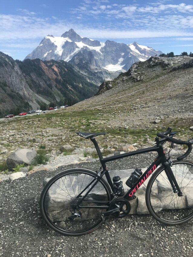 View of Mt. Shuksan from Artist Point. Ian Haupt photo
I stumble out of my room in boxer briefs in search of the bathroom. There’s a bed frame taking up half the hallway. In the living room a portable table is covered with SOLO cups and half-full beer and seltzer cans, there’s two people snuggled up on the couch. I turn back for my intended destination. I’m dizzy.
Dressed, I grab my bike from the garage, fill up my water bottles and head for my car across the street. One of my roommates has parked me in. It’s not yet 8 a.m. – too early to wake them up. I text.
I head back to my room and lay on my bed, shoes on, to wait. I wake up after 10 a.m. and call. The voice on the other end is not pleased but obliges.
I stop for an Americano and breakfast sandwich on my way out of town and start to feel a little fresher. That extra two hours of sleep means the sky is already clear and I can see my destination as I turn east.
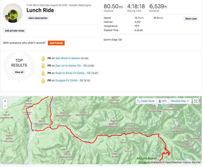 Strava file.
Two weeks until the Mt. Baker Hill Climb on September 12, I’m headed to check out the course but more importantly, see if I have any climbing legs.
With little preparation or planning done, when I see the wide-open parking lot of the Whatcom County Library System’s North Fork branch I pulled right in. I take my bike out of the trunk and undress in the car. After some odd looks from a Whatcom County Fire District 14 firefighter, picking up some produce from the Saturday market outside the library, I am ready to go.
I have two goals for the day: Ride Silver Lake Road and up to Artist Point. If you’re thinking one might be more of a priority than the other, you obviously haven’t ridden Silver Lake Road. It’s a top three contender for best stretch of open road in Whatcom County – Chuckanut Drive and Mosquito Lake Road taking the other steps on the podium.
Now, whether to do it before or after climbing Baker was the question. Long, breezy descents tightening my legs, the easy answer was before. So I head north on Kendall Road.
My legs are stiff the first ten miles and I wonder if I have enough in them for this ride. “Oh yeah, how long is this ride?” I’ve climbed Baker from Glacier and that was 50 miles. And Glacier can’t be more than 10 miles from Kendall via SR 542, so around 70-75? But with more elevation gain than I’ve done this year.
Climbing up and into Silver Lake Park from the north, I’m cruising. This winding valley road and its rolling hills will put you in the mood.
I drop down into Maple Falls and take a left onto a busy 542. Most are thoughtful, only a few come in range of my left elbow. Already finished with one of two bottles and no idea what will be open at the meadows, I consider stopping to fill up in Glacier but start the approach not wanting to interrupt the momentum.
While there’s plenty of hamstring use before, the climb seems to unofficially start after crossing the Nooksack River’s North Fork. From there it doesn’t level off until Heather Meadows. By the time the switchbacks start you are in it and feeling it. The tree line thins and views of Mt. Shuksan allure attention from the road.
“Go, go, go. You’re almost there,” says a motorcyclist taking photos of Shuksan’s north face just past the ski area parking lot, five miles from Artist Point.
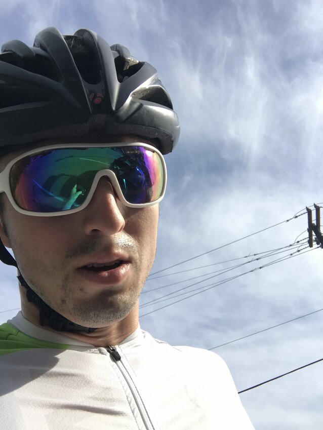
My back is aching and legs are heavy. I’m riding steady, not pushing the pace too much – maybe once or twice around corner. Today is about putting in the miles and reminding the legs what this climb is like.
I reach the meadows and the road is lined with cars. Parking lots and turnoffs overflow onto the road. Couples and families walk along the road to trailheads and viewpoints, as groups of hikers are visible on the trails. While it’s nice to see this many people out, it’s also nice to know the road will be closed on race day.
I make it to Artist, wait in line for the restroom and take the obligatory bike photo before heading down. I stop at the open Heather Meadows Café for some much needed water.
Some people look forward to descents. I’ve never been one. The risks largely outweigh the reward for me. That’s not to say I won’t take them. I’d just rather earn my speed. (Don’t get me started on e-bikes.)
 Back at the car. Ian Haupt photo
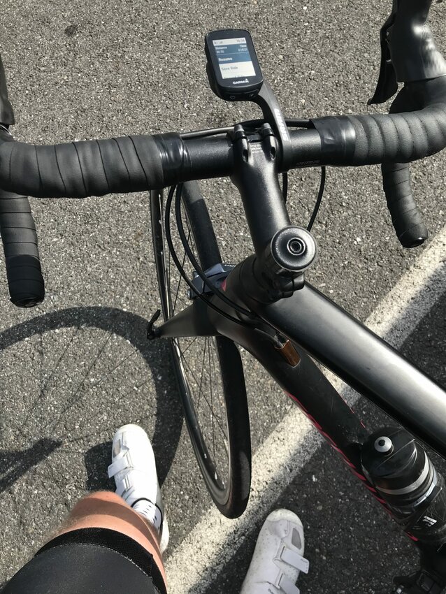 Remember to save those files. Ian Haupt photo
I avoid a couple narrow ones and I’m soon enough rolling along next to the Nooksack on my way to Glacier, thinking about what I should eat post ride. I hit Maple Falls and the Yuki Yama parking lot is packed. I don’t think I’m headed back this way. Rolling down into Kendal, the taco truck next to the library catches my eye and nose.
Back at the car, I throw the bike back in the trunk, undress quickly and pull up for an adobada burrito and Jarritos. Refueled, I enter the lineup of cars driving into the sun with a clear head.
For more information on the hill climb, visit bakerhillclimb.com.


