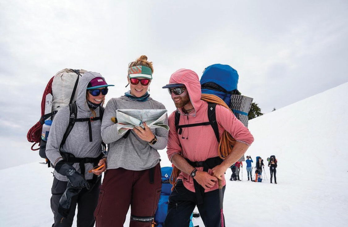
If you can see Mt. Baker, you are part of The Experience
The use of a GPS has never been easier. In the old days, we carried around bulky devices that didn’t even have the capacity to allow for mapping. They just directed you to waypoints.
Since then, things have changed dramatically. Indeed, mapping apps for your phone are now an integral part of wilderness navigation. They tend to work incredibly well, allowing you to track your movement and ensure that you always understand your current location. However, they are not all built the same, and depending on your specific activity, one app may be better than another for you. And indeed, in some cases you may feel the need for more than one app.
Here, we’ll look at several different options that I have used both alone and in conjunction with one another, their advantages and disadvantages and, hopefully, give you a place to start if you’re looking for a new mapping app.
It is important to remember that every single one of the following apps requires you to download the maps you need before you’re out of service. If you have the map downloaded in your phone, you will be able to turn your phone to airplane mode, the map will render and you’ll be able to see where you are.
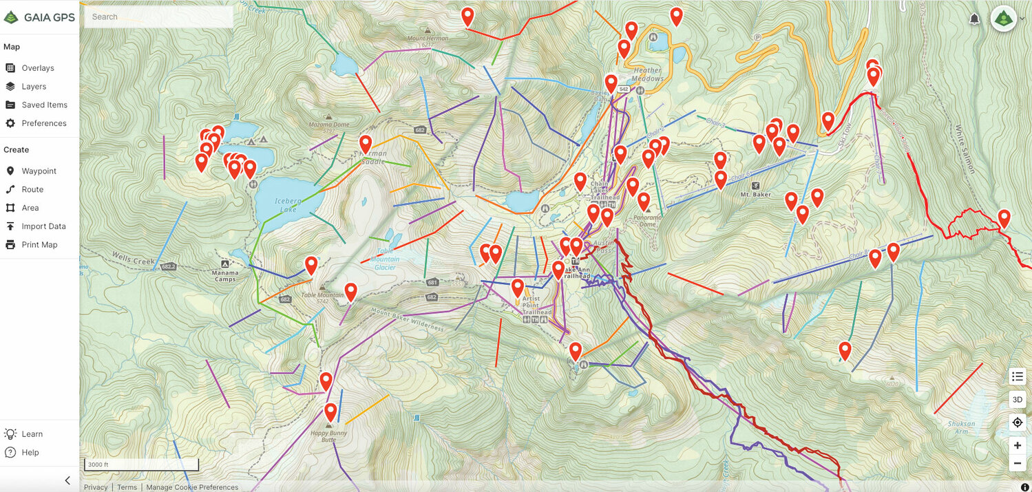
I’ve been an active user of Gaia GPS for the better part of a decade, and I find it easy to use. It has several map layers available at any given time, it’s easy to import tracks and perhaps best of all, is really easy to plan on the fly without a desktop to work with. It is an incredibly friendly app for field-based navigation work.
Gaia GPS has always been a little bit ahead of the curve. New updates usually make the app better and easier to use. But with so many quality competitors on the market, they’ve had to make some other changes to stay ahead. The most interesting new feature they’ve done is partnering with Outside+, so when you get a subscription to the varied outdoor publications that now live under that banner, you also get a subscription to Gaia GPS.
There are a few things I don’t like. Of particular note, the way data is organically managed can be difficult. It’s often hard to find saved items (e.g. waypoints, tracks, etc.) without finding them on the map first. To do this quickly, I’ve developed my own cataloging system, something you shouldn’t have to do.
There are a couple of other things that could be better. The satellite images can be dated. Weather tools are weak. Map printing can be poor. And land management lines are not always apparent.
While I like Gaia GPS and it works well, it still could be better. And honestly, if I didn’t have to move reams of data from one platform to another, I’d be more open to switching to another platform.
I first experienced CalTopo as an exceptionally well-performing online mapping application. I used the online platform extensively to develop personal route plans as well as to develop maps for commercial land use permit applications (I work at the American Alpine Institute). Indeed, there was a period where I preferred CalTopo for online planning, and Gaia for smartphone planning.
Eventually CalTopo’s app caught up to the online interface and now the two work well together. Though, I would argue that there is a learning curve. CalTopo isn’t always the easiest to use.
Like Gaia GPS, it appears that CalTopo had to find some kind of niche that made it competitive with the other options out there. As such, they developed a search and rescue version of the app that is referred to as SAR Topo. This adjunct can be used by SAR management and rescuers to manage emergencies, rescues and searches for missing people. It is a very cool add-on for those who do that kind of work.
In the scheme of things, CalTopo has taken a leadership role in most aspects of the navigation app world. It doesn’t burn through as much battery as others, the terrain resolution is awesome, the layering options are great, and this is by far the best app for map printing. If you intend to carry an analog map, you can build CalTopo maps at whatever scale you need.
The biggest downside is that it is hard to use for route planning in the field. It’s possible to do, but it takes some practice.
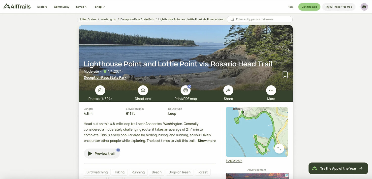
All Trails is a weird one. Many websites and blogs link directly back to this particular product. It’s likely because All Trails is really about trails and not about backcountry navigation. It provides you with a lot of options wherever you are.
There is a free version of All Trails that you should probably get just to peruse the trails in any given area. But the All Trail Pro version provides a lot more options.
I’m not a huge fan of this app due to the difficulty in planning for unusual adventures like backcountry mountaineering. But if you’re more of a “stay-on-the-well-marked-trail” type person, then this could be the app for you. I do have a free account though, which allows me to look at web-linked trails.
OnX Backcountry is the newest product on the market. When it first came online, mountain guides were given early access, and now some are using it exclusively on their programs, converting more people over to OnX.
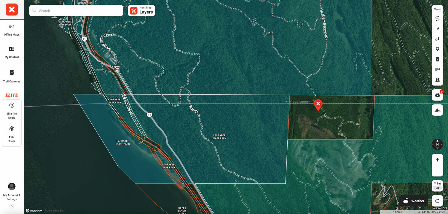
There are some cool features. It provides information not just on fires in a given area, which is a function available on other apps as well; it also provides info on historical fires. This can help you with your planning long before your adventure.
Another interesting feature is that you can share waypoints with other users through satellite messaging. This is accomplished through a service called Somewear.
And finally, OnX is the best app out there for those concerned about property lines. OnX provides detailed information about public and private property within their maps. This is really important for those that need to avoid private property on their hunting and fishing adventures. I’ve used this extensively to determine land management and private property for some of my guidebook projects.
The app, however, is far from perfect. There are limited layers. Importing data is hard. And route building both on the desktop and on the app is more complicated than it needs to be.
I suspect that this app will continue to evolve. In a couple of years it will be as clean as CalTopo and Gaia GPS, if not cleaner.
FarOut was originally an app called Guthook, which was primarily used by thru-hikers on National Scenic Trails. At some point, the company rebranded.
If you are thru-hiking any portion of the PCT, this is by far the best product. There is a tremendous amount of crowdsourcing implicit in the app. You always know how far you are from a campsite or a water source. And you also always know how good the site is and whether or not the water is running.
The app makes hiking on one of these trails incredibly easy. You don’t feel pressed when it’s late and you pass what looks like the last site for a while. You can see where every single tent site is along the trail and how far away it is.
The problem with FarOut is that if you want to get off the trail somewhere, or you’re trying to figure out where a spur trail goes, information may be sparse. This app is best used in conjunction with another app if you’re dipping in and out of National Scenic Trails.
It is odd.
In every case listed above, I mentioned how the app wasn’t perfect, that I needed another to supplement it for one application or another. At some point, one of these will take off and offer all of the things that combined to make each of the individual apps listed above valuable.
But until we have “one app to rule them all,” we’re still stuck with a patchwork. Which means that for most people, they’ll pick the one that makes the most sense to them. X


