If you can see Mt. Baker, you are part of The Experience
 Map courtesy of the Port of Bellingham.
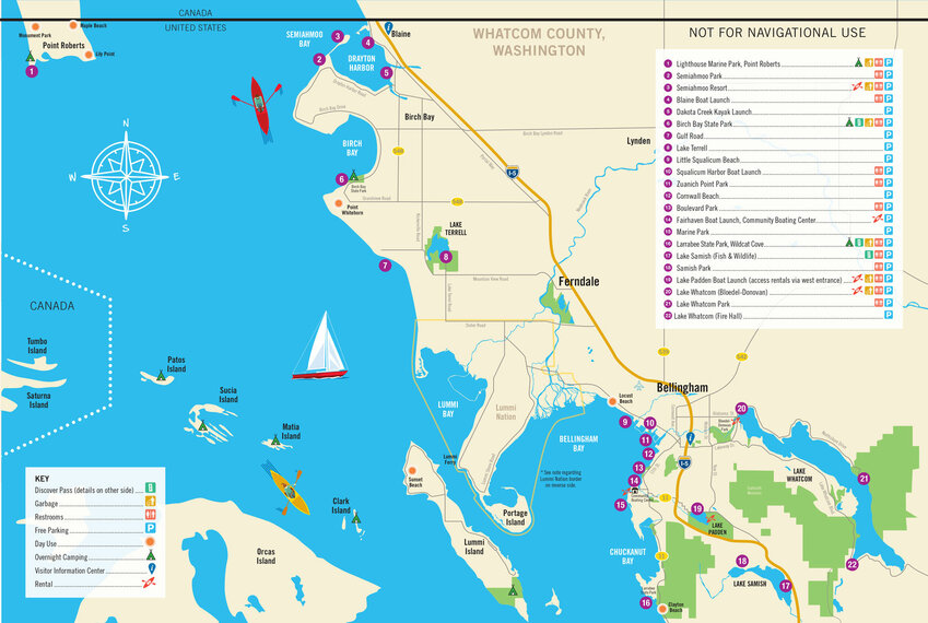
The Port of Bellingham is releasing a promotional map to water access points along Whatcom County’s marine shoreline and freshwater lakes.
The first version of the Whatcom Water Trail map will be distributed to promote our region as a water sports destination and an initial step in a longer-term process. We will continue working with local landowners and engaging the public to identify key locations and prioritize improvements for safety and access. River access will be included in a future version. We will also begin seeking public input at the Paddling Film Festival on April 3, at Bellingham Technical College.
Gina Stark, project manager with the Port of Bellingham’s Regional Economic Partnership, lead the project with help from Recreation Northwest, Kristi Kucera of Moondance Sea Kayak Adventures, and our local public land agencies. Credit for support of the map goes to Port of Bellingham commissioner Michael Sheppard for recognizing the value of public access to our waterways.
“This has been an amazing cross-agency collaboration, working with city of Bellingham parks, city of Blaine, Whatcom County parks, Washington State Parks, DNR and Lummi Nation,” Stark said.
As executive director of Recreation Northwest, Todd Elsworth promotes outdoor recreation and brings community together to enjoy, preserve and improve the places where we play.


