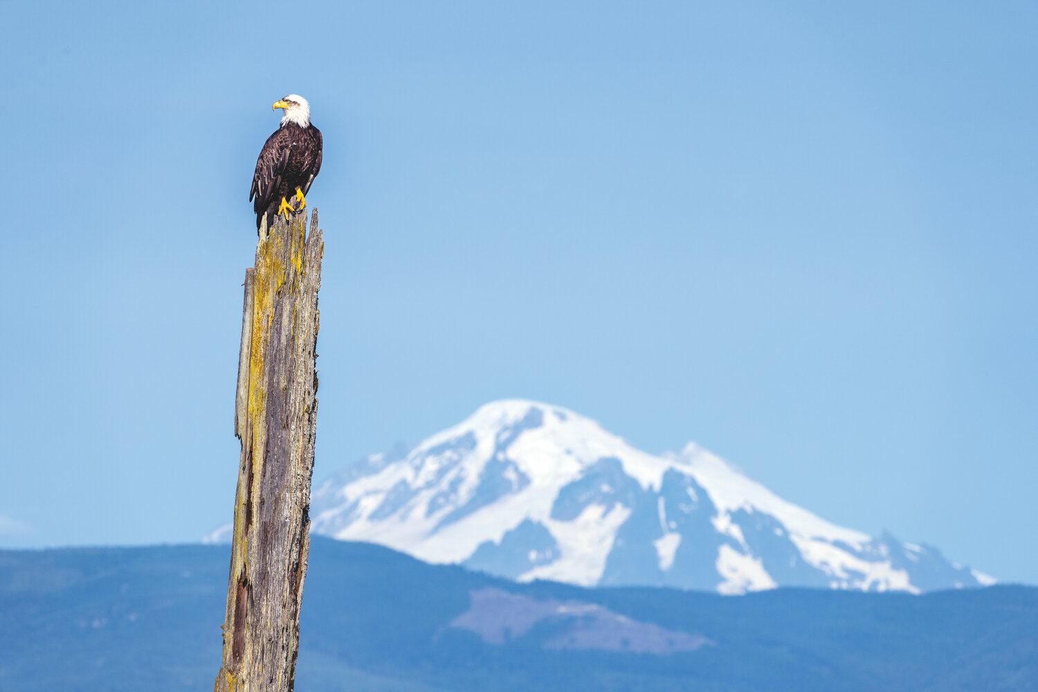
If you can see Mt. Baker, you are part of The Experience
From snowflake to sea swell, water has a cycle. A circulatory system whose seasonal heartbeat pumps snowmelt into this green and gracious land so many of us have come to call home. Yet any appreciation I’ve had for Washington state and this process, has been limited to the Cascade Mountains and their mantles of ice. Once those rivulets were spun from the glacier, it was out of sight, out of mind, and the impact their accumulations had upon the fabric of our environment was ignored. Once I’d realized that, it became imperative for me to trace that story from summit to sea.
With the thesis for my project established, I needed a destination. I found it on Washington state’s northernmost volcano, Mt. Baker (10,786 ft.). From it flows the Nooksack River, a free-flowing stream that is nearest to its pre-industrial state, headwaters to the estuary, than any other river in this region. For that reason, among others, it became my chosen path.
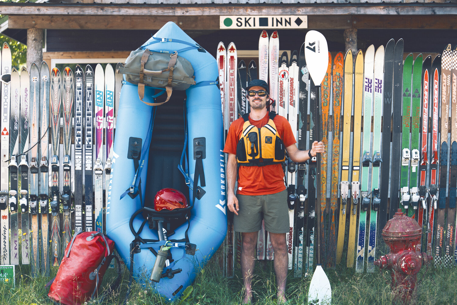
With a mountain and river in mind, my next objective was a logistically feasible plan. What I came up with was a transit over Mt. Baker’s summit with skis. The ascent would be by the Easton Glacier (with a camp on the summit) and the descent would be by the Coleman-Deming route. For the transition to water, I would begin with a pack raft at Glacier Creek bridge (considered intermediate to advanced difficulty) and, joining up with the Nooksack River (easy to intermediate), I’d continue to Bellingham Bay and the Salish Sea.
June 30, 2023: Easton Glacier to Summit Ice CapThe route up Mt. Baker’s upper slopes is covered with flowers and viridescent forest, all bursting with life after another turn of winter. Murmuring in every low vale are streams and shouting from every high cliff are waterfalls. Fracturing the broad flanks are slopes riddled in crevasses. Nothing of man except a path and tents mar the pristine alpine scenery.
My partner for this adventure, Sage Vogt, and I set off at 1 p.m. with strides as wide as our smiles. Behind us, Delilah, Sage’s better half, drove off after shuttling us partway up the mountain to the trailhead.
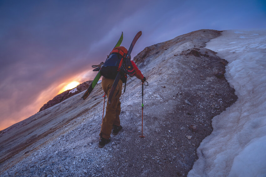
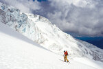
We raised our eyes toward the Easton glacier and the summit 7,500 vertical feet above us and the climbing began. As I walked, I remembered how the glacier was named. In 1909 the Mazama Club asked Charles Easton (1858–1931) what he would call it. He suggested Twin Glacier, but after he departed for home, the Mazama members christened it Easton Glacier.
Outside Easton’s work as a local historian, his greatest contribution to Mt. Baker was a map he published in 1912. What I love about maps are the stories hidden behind the names and symbols. For example, below the Bastille Glacier, barely discernible, is a cross. Written below it is the word “grave.” But whose grave? When and how did that person die?
The story dates back to July 1891 when three prospectors from Blaine, Washington attempted to climb Mt. Baker. They never made it. As they reached a point above timberline, one of them, Richard L. Smith, spotted mountain goats. In those days, hunting was as much sustenance as sport. Sadly, in Smith’s exuberance, he inadvertently shot himself through the arm, severing his brachial artery. Within seconds, he fell to his knees, tumbling 200 feet down the steep, rocky slope they had just climbed. By the time his friends rushed to his side, it was already too late. With extreme difficulty, his body was carried back up the moraine. He’s there still, buried above the headwaters of what has long since been called Smith Creek.
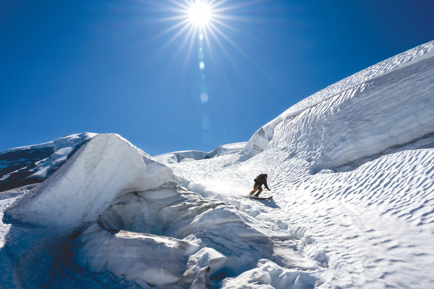
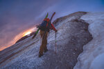
We soon climbed by serac fields, tottering towers of ice, jumbled and split by gravity. Chasing sunset, we swept by them, following cloud shadows that cooled us until they passed. Then heat would blast us, as hot as 100 degrees, and as fierce as any desert sun. Not until we made it to the final headwall did the temperatures moderate.
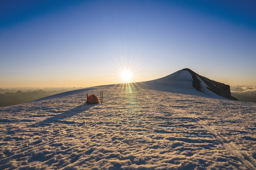
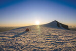
At the summit, freezing fingers yanked my tent from my bag, and Sage helped me pitch it. An hour later, stars shone overhead, bleeding through the blue hour’s bright facade. As we sat alone on this mountainous rooftop, I gazed upward, transfixed, lost in the night’s sky. Without conscious awareness of it, I unanchored myself. Between terrestrial and intergalactic planes, I paddled into that gulf that separated me from everything and fell asleep dreaming of star clusters and super massive blackholes.
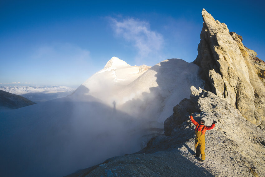
July 1, 2023: Mt. Baker Summit to Glacier (the town)A side trip to the true summit of Mt. Baker at 8 a.m. placed Sage on the top of his very first volcano. The view reveals half a dozen ecological zones. The Pacific Ocean lies to the west, the Fraser Valley to the north, the spine of the Cascade Mountains to the south and the dry scablands to the east.
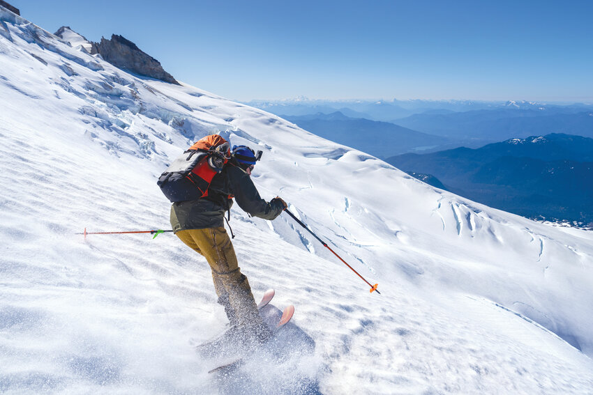
From the crest of the summit dome, we cut our skis into ice-ribbed slopes, sun-cupped and pockmarked by old steps and rocks. The price of our night’s camp was an icy ski. Each turn clattered our teeth. Every stop strummed frayed nerves across shaky knees.
After a vertical mile of descent, we reached bare ground. Lush grass and various bushes sprouted wherever they could take root. All of them newly arrived tenants to replace evicted glaciers. Glaciers I’d seen covering this very earth just two decades earlier.
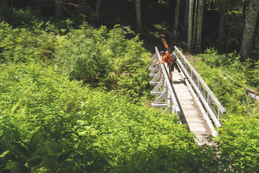
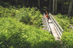
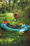
At the trailhead, Sage and I continued another five miles to Glacier Creek bridge, a half mile past the current road washout. Once again, Delilah, our knight in shining armor, came to our aid. This time she had our fresh water stallions i.e., pack rafts, on board.
It was an hour later, after a beer and a prepped boat, that I scouted Glacier Creek from the bridge. Conditions were touted as good enough, and good enough is all you can ask for.
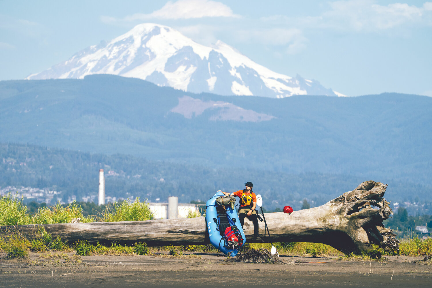
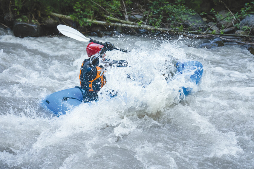
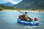
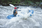
Once we casted off from shore, our control was limited to paddle strokes. Even as I slid from a car-sized boulder into the swift current, hardwired instincts took over. In seconds, I slipped between a narrow channel, dove off a pour over and spun out into an eddy. Upstream, I watched Sage hit every mark he needed too, and knew we had 65 miles ahead and nothing more to stop us.
Of course, we spoke too soon of easy goings. Smiles faded as we climbed around yet another logjam. Each time hopes would rise, another pile would appear. I remembered how my friend Ben passed away 20 years ago while kayaking the Grand Canyon of the Elwha. It was his PFD I was wearing now. I wear it to remind me that fear and danger, thrill and challenge are currents all their own, and that we have to balance those realities with our own skills and the conditions we find.
After several hours, we stashed our boats just outside the town of Glacier with hopes its sole restaurant was open. It was closed up, so we raided the local market and soon returned to camp.
July 2-3, 2023: Glacier (the town) to Bellingham Bay
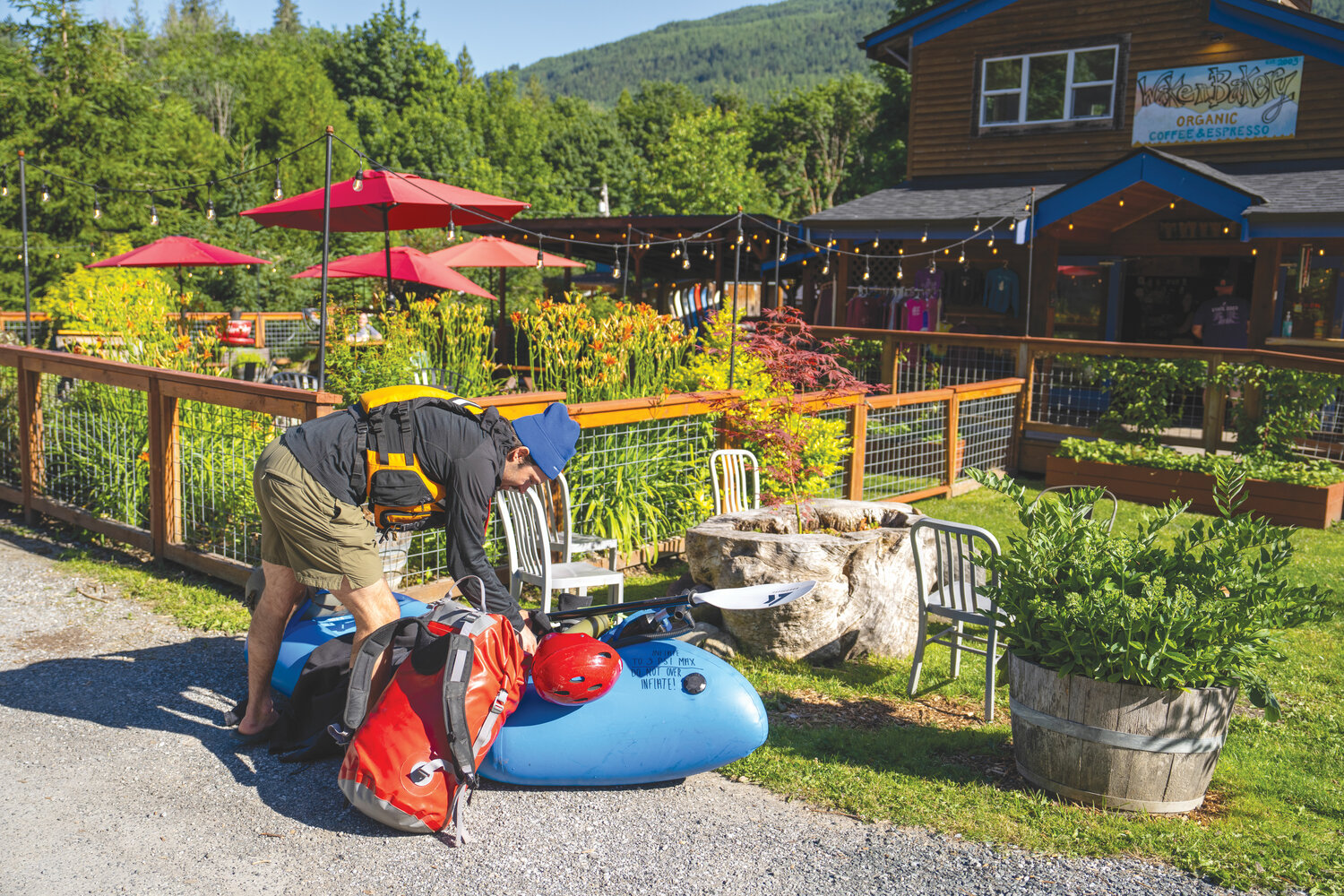
Mosquitoes and stinging nettles battled us as we packed bags and sorted gear. A side trip to Glacier’s Wake’n Bakery and cold water from the Nooksack salved all wounds. I couldn’t imagine a more idyllic way to begin the day.
Could this morning get any better?
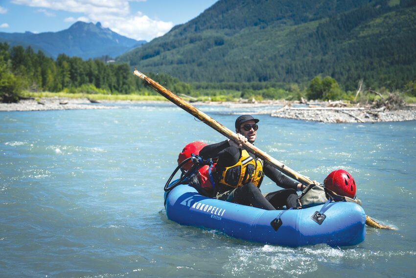
In a mid-river transfer of gear, we attempted to make it worse. After Sage left his boat and paddle atop logs, he pulled my boat up. Soon after he cried, “Where’s my paddle? Did you see my paddle?” We both looked downstream at the same time. Glinting in the waves, in the far distance, was his paddle.
I leapt in my boat and Sage flung me from the logs. I paddled like a man possessed. Just before another logjam, breathless, I managed to snag it.
As I waited for Sage to come down, what I craved right then was a river beer. But even if I had one at hand, it couldn’t have competed with the thrill I got when I saw Sage. As he neared, he had a substitute paddle, an 8-foot branch.
Tired and ready to be done, we pulled our boats up fist-sized rocks to a sandy patch just big enough for our tent. Sage’s watch told him we’d gone 30 miles. With camp pitched, we rested against a log.
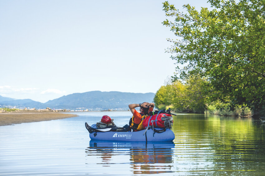
Thoughts of the day flowed back upriver. Few houses were seen. Diverse forests and natural shorelines predominated throughout, a surprise to me.
With an early rise, we set our goal to be in salt water before sunset. Every trip has a turning point, when the momentum of the end pulls you toward the finish line. If 30 miles could be done the day before, we saw no reason it couldn’t be done again.
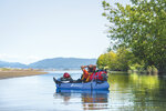
As paddle stroke follows paddle stroke we are drained through Cottonwoods and alders, pulled past frothing and boiling water into green and turbid pools. I thought the water would slow, but outside strong breezes around several bends, we found the going as good as we’d hoped for, and nothing short of another perfect day.
Bridges for railroads and cars were passed under, but none so thunderous as Interstate 5. The health of the river, from all appearances, was undeniably changed for the worse, but as the miles passed, we found the river recovering.
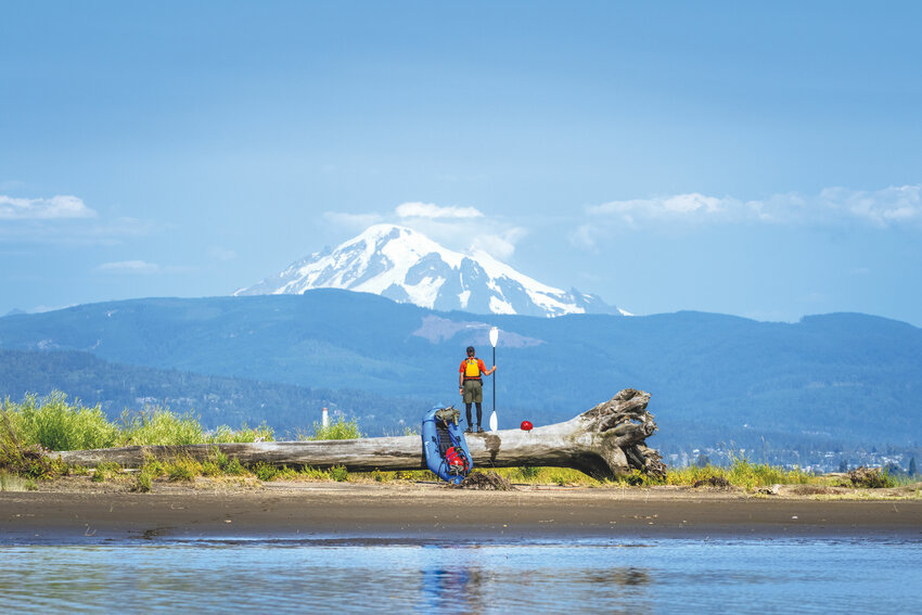
Around 3 p.m., we entered the Nooksack wildlife area. It’s an estuary whose outlines are made up of muddy shores and stacks of driftwood. Through its fluid center, we kept moving, afraid that we’d be fighting tides.
Then, like that, we were there. From Bellingham Bay, Mount Baker rose like a cloud cap, white and bulbous.
From the billions of accumulated snowflakes on Baker’s summit, to the billions of accumulated raindrops crashing onto the shores of the Salish Sea, I ask myself: What have I learned? What wisdom was spun out of those endless eddies?
Water will outlive us. Earth will outlive us. How we live, and what balance humans strike with nature, that alone will determine if our story will move with the current or against it. X