If you can see Mt. Baker, you are part of The Experience
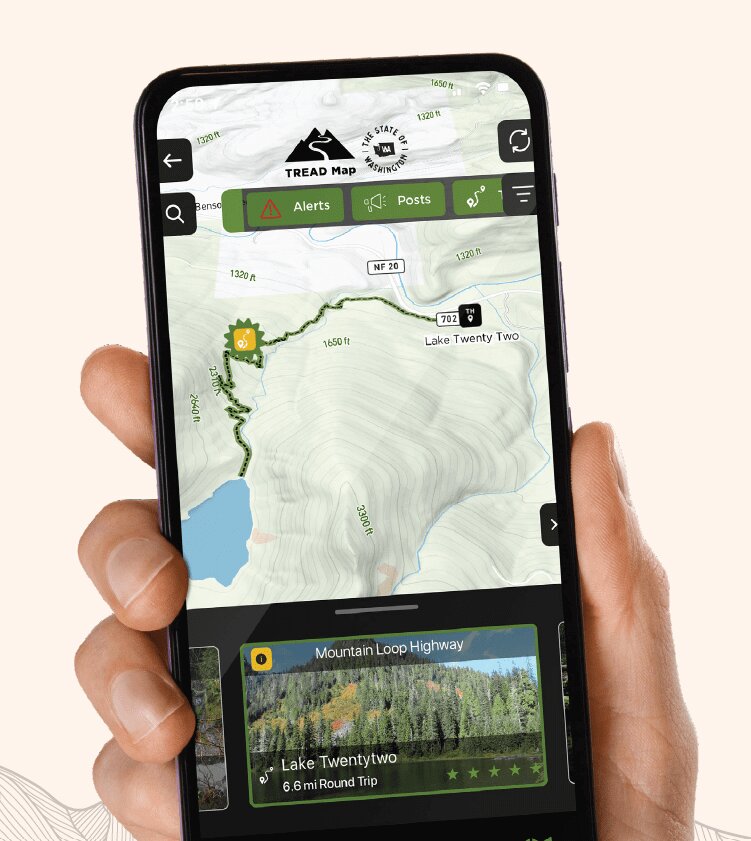 A screenshot of a trail in the TREAD Map app. Courtesy photo
The TREAD Map app provides alerts and real-time updates for outdoor enthusiasts to avoid crowds and trail impediments.
The app incorporates Washington’s trail systems, waterways, mountain bike trails and other outdoor recreation areas to introduce users to new trail systems and inform them of area conditions. Users can also post on TREAD Talk to notify local land managers of current trail conditions.
Washington Tourism Alliance and Dharma Maps originally launched TREAD Map as a pilot program in summer 2021. It provided trail data for Kittias, Grant, Douglas, Chelan and Okanagan counties, areas that often get heavy public land use during the summer, at the time.
The full launch was created through partnerships between State of Washington Tourism, TREAD Consulting and Dharma Maps, according to the State of Washington website.
The app is available on iPhone and Android. For more information or to download the app, visit stateofwatourism.com/tread-map-app.


