If you can see Mt. Baker, you are part of The Experience
 | |
Feet First | |
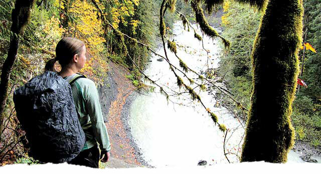
| Snow-free winter hikes Story and photos by Aubrey Laurence Many day hikers are leery of snow-covered trails, and come winter they put their passion into hibernation. It’s understandable because snow completely changes the game. It limits trailhead access, creates routefinding challenges, requires extra gear, makes hiking more tiresome and produces dangerous situations, such as slick surfaces, deep snow and avalanches. But there’s no need for hikers to hang up their backpacks for the season. There are many wonderful hikes in northwest Washington that stay snow-free most of the year, and when they do receive snow, it tends to melt off fast. Below are five winter hikes to keep your passion alive through the season: ALGER ALP. Unofficially named Alger Alp and also known as “Little Baldy,” this little mountain can be seen from I-5 in between exits 240 and 242. In conjunction with Squires Lake Park on its north side, this is a great area for hiking, trail running and bird watching. There are two routes to the summit – one from the north through the Squires Lake Park off Old Hwy 99 and one from the south from Alger-Cain Lake Road (which is Lake Samish Road west of 99). The Pacific Northwest Trail runs along a good portion of both routes. Depending on the route you take, you could easily do four miles round trip and gain at least 1,000 feet of elevation, so it makes for a good, quick-fix hike just 15 minutes south of Bellingham. And at just 1,315 feet high, Alger Alp is low enough to stay snow-free for most of the year. The south route follows the defunct Logging Road 1000 to the summit. The north route passes the northwest tip of Squires Lake, heads south on the Squires Lake Loop Trail, takes a right onto the narrow South Ridge Trail, and then turns into Logging Road 1340 and then 1300. When it links up to Road 1000, it follows it around the north side of the mountain. At the end of the road, a trail leads to an open area on the summit. Ignore the din of I-5 far below and cast your eyes toward the islands and the Olympics to the southwest. Directions: For the south route, take Exit 240 to Lake Samish Road, then head east through Alger. Past Highway 99, the trailhead (gated Road 1000) is on the left, just past Corbell Lane and before the bridge over Silver Creek. Park on the shoulder on either side of the road, but do not block the gate. For the north route, take Exit 242, go east on Old Highway 99, which will then turn toward the south. In less than a mile, the Squires Lake parking area will be on your left (east) side of the highway. HORSESHOE BEND. On cold and rainy days, few consider heading up into the hills, but that’s exactly why you should. The Horseshoe Bend trail is a great destination on days like this because most of the trail is protected from the wind and rain by a dense canopy of cedars, hemlocks and Douglas firs. It’s also a low-elevation trail that tends to be snow-free most of the year. Sure, it may lack sweeping vistas and mountain views, but it still has a lot to offer. Beginning right off Highway 542, the trail travels through a moss-covered forest as it contours the raging, boulder-strewn North Fork Nooksack River. Along the way, there are many great whitewater views and idyllic picnic spots. The trail ends at a precipice high above the Horseshoe Bend. This is a relatively easy hike, though it does have many ups and downs, including a few sections that will get your heart pounding. If you hike the trail all the way to the end and back, you will travel almost 2.5 miles and gain more than 400 feet of elevation. Some guidebooks only give it 200 or 300 feet, but they don’t seem to account for all the dips and rises, out and back. Directions: Drive east on Highway 542. Two miles beyond the Glacier Public Service Center, park on the right side of the road, just past the bridge and across the street from the Douglas Fir Campground. DECEPTION PASS STATE PARK TRAILS. It may not feature long trails in remote forests or sweeping alpine views, but Deception Pass State Park does have 38 miles of short, interconnecting trails and loops that offer plenty of eye candy. The best part is that you can tailor a hike to your time or energy constraints, whether you just want a short stroll along a beach or a long, circuitous route. On the north side of the bridge on Fidalgo Island, consider exploring the Bowman Bay area, which offers quiet beaches, rocky cliffs, old forests, grassy knolls and hidden coves, plus panoramic views of Deception Pass, the Olympic Mountains and the San Juan Islands. If you combine hikes to Rosario Head, Lighthouse Point and Lottie Point, you will hike at least five miles and gain about 400 feet of elevation, as there are many ups and downs on these trails. There are also many spur trails to explore, though some of them are overgrown, slick and dangerous where they cross above cliffs (especially on the north side of Lighthouse Point), so proceed with caution. Directions: Deception Pass State Park is located off Highway 20 between Anacortes and Oak Harbor. To get to Bowman Bay from Anacortes, go south on Highway 20, turn right onto Rosario Road and take an immediate left onto the park road to Bowman Bay, making another left to the boat launch and day-use area. A Discovery Pass is required. NORTH BUTTE ON BLANCHARD MOUNTAIN. Instead of doing the ever-popular Oyster Dome hike, go farther and higher to the lesser-known North Butte, which has similarly inspiring views, plus a great view of Mt. Baker on clear days. It even features a very short scramble right at the top. There are many ways to gain this sub-summit of Blanchard Mountain’s highpoint (which is covered with trees, has no views and requires a bushwhacking session), and many loop hikes are possible. Most pass by Lily Lake. From the west, you can hike to North Butte from Chuckanut Drive; from the south, you can hike it from Samish Overlook or the junction of roads B-2000 and B-1000; from the east, you can gain it from the Alternate Incline Trail after hiking up the gated road; and from the north you can reach it from the British Army Trail. The Chuckanut Recreation Area map (squareonemaps.com) details your many options, which are only limited by your creativity and energy. Directions: For the south-side routes, take Exit 240 from I-5 south, turn right (north) onto Lake Samish Road, left onto Barrel Springs Road, and then right onto the Blanchard Mountain gravel road B-1000. For the hike from Chuckanut Drive, take Chuckanut Drive (11) about 10 miles south of Fairhaven, just past the Oyster Bar, and park on the right (west) side of the road. A Discover Pass is required. MOUNT CONSTITUTION. Out of the 700 islands that make up the San Juan Islands archipelago, Orcas Island is the tallest, with Mount Constitution prominently rising 2,409 feet straight out of the sea. The mountain is within Moran State Park, which has 5,252 acres, five freshwater lakes and more than 30 miles of hiking trails that are typically free of snow most of the year. There are many routes you can take to Mount Constitution’s summit, including a road. But to experience the mountain best, do the 6.7-mile-loop hike starting at the parking area for Mountain Lake Campground. Taken counterclockwise, this route gains about 1,500 feet in total, as it contours the west shore of Mountain Lake, gradually ascends north through a lush-green forest, and then steeply ascends west before wrapping around the north side of the mountain to the summit. You will encounter many side trails on this loop, some of which make worthy extensions on their own, so be sure to bring a map. No summit visit is complete without climbing to the top of the stone tower, which was built by the Civilian Conservation Corps in 1936. If you’re lucky enough to be there on a clear day, you’ll have commanding, 360-degree views of northwest Washington from Mt. Baker to Mt. Rainier, Vancouver and lower British Columbia, the San Juan Islands, Vancouver Island and the Gulf Islands. To complete the loop, head south from the summit on the Little Summit Trail, which skirts above cliffs (hike cautiously if the trail is wet or icy) and gently undulates along the long summit ridge before descending steeply down the mountain’s southeastern shoulder. This trail connects back to Mountain Lake, just north of where you parked. Directions: Take the Washington state ferry from Anacortes to Orcas Island. Turn left after disembarking the ferry and take Orcas Road to the town of Eastsound. Drive through Eastsound and then take a right onto Olga Road to Moran State Park, and then left onto Mount Constitution Road. After about a mile, turn right and park in the Mountain Lake parking area. A Discover Pass is required. In the winter the park is open 8 a.m. to dusk. For more information and to download a trail map of the park, visit parks.wa.gov/parks/?selectedpark=Moran.X Aubrey Laurence spends as much time in the mountains as possible. He lives in Bellingham with his wife and two cats.
|